Africa: History and Culture: Home
This guide is a resource for those studying Africa in the social sciences and history.
The goal of this guide is to provide you with the most helpful library resources about the historical, archaeological, and anthropological study of Africa. Select from the tabs above to navigate the different steps in the research process.
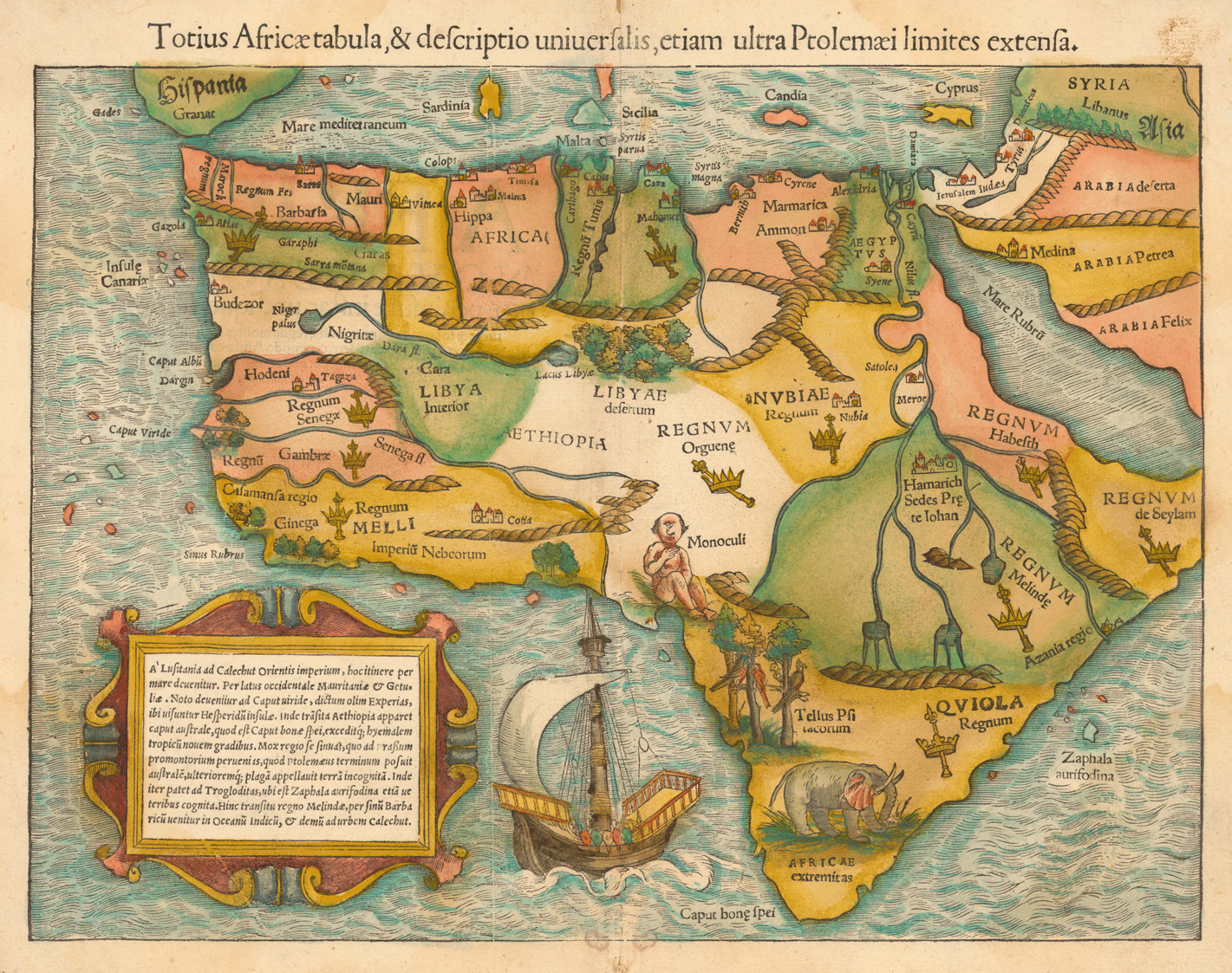
Historic Map of Africa

1554 map; , Sebastian Münster, 1489-1552.
“Totius Africæ tabula, & descriptio uniuersalis, etiam ultra Ptolemæi limites extensa.” Woodcut map, with added color, 26 x 35 cm. From Münster’s Cosmographia uniuersalis (Basel, 1554). [Historic Maps Collection]
The earliest obtainable map of the whole continent of Africa."
From Princeton University Libraries, https://library.princeton.edu/visual_materials/maps/websites/africa/maps-continent/continent.html
Want more historical maps of Africa? Use the links below.
-
Maps of Africa (Northwestern University)This collection features digital copies of 113 antique maps of Africa and accompanying text dating from the mid-16th Century to the early 20th Century.
-
AfriterraThe AFRITERRA LIBRARY embraces a philanthropic mission to preserve and apply the rich cartographic record of Africa, enabling historical interpretation and transformative education. In 1995, a private foundation established the featured facility in Boston Massachusetts with a material endowment defining 5000 of the rarest original maps focused on Africa. This distinction is achieved by cataloging and digitizing the vital information marked on fragile documents that span 500 years. The complete scope covers all regions and scales in 8 different languages. By securing and presenting such a deep archive, the effect is to sort through history, to be so explicit as to uncover the roots of a continent.
-
Maps of Africa: An Online Exhibit (Stanford University)An online exhibit featuring Stanford University library's collection of maps of Africa.
African News
Looking for the latest in news from Africa? Try these sources.
